
HIGH DETAIL WORLD MAP FOR POWERPOINT
Customizable Map of the World in a ready to use PowerPoint file consisting of high detail* map outlines of more than 230 countries and islands worldwide. Including 6 different color schemes and styles to match your design requirements and to offer you a creative advantage.
You have to highlight several locations on the World Map and you are not sure where they are located? No problem! Use the built-in Selection Pane and easily choose the countries by name on a list of over 230 states and islands worldwide – arranged in an alphabetical order.
Make use of the probably simplest and efficient way of creating insight in global developments in your PowerPoint business presentation. Work fast and error free. No atlas needed.
Contents
- World Map – all over outline (Antarctica separate shape)
- World Map – 6 continent outlines (North America, South America, Africa, Eurasia, Australia, Antarctica) with selection List
- World Map – 7 continent outlines (North America, South America, Africa, Europe, Asia, Australia, Antarctica) with selection List
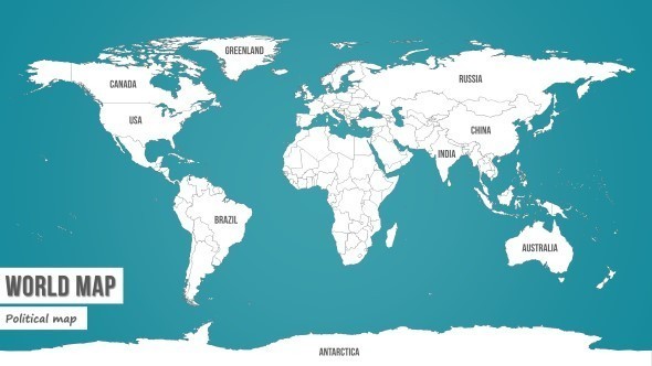
- Political World Map consisting of over 230 editable country and island shapes with selection list in an alphabetical order (Including Oceans)
- Marker Kit – Slide with over 30 matching markers, symbols, pins and icons
- Color schemes & styles: Grey-Blue / Yellow / Orange / Dark Cyan / Textured
- Easy step by step instructions PDF file
Features
- 230+ single country shapes
- All 7 continents
- All 5 oceans
- 35 unique slides
- 30+ markers, symbols, pins and icons
- 5 different color schemes & styles
- Built in country select list
- Screen & Beamer ready
- Printing optimized (300 dpi ready)
- Easy customizable contents
- Aspect ratio 16:9 widescreen
- Retina ready & Full HD
- All icons and contents are 100% editable
- 100% Vector shapes
- 7 creative textures
- Free fonts used
- PPTX
- Easy instructions PDF file
- Select countries, islands and oceans by name in the world list of country names
- Easily coloring countries selected (multiple selection possible)
- Highly detailed maps drawn as standard PowerPoint objects
- Your global developments presentation set up in minutes
- Don’t get confused and never make mistakes
Used Fonts
- Calibri (Windows system font)
- Calibri Light (Windows system font)
- Segoe Print (Windows system font)
- Armonioso (http://www.1001freefonts.com/armonioso.font)
- Biro Script reduced (http://www.fonts2u.com/biroscriptreduced.font)
- Bebas Neue (http://www.1001freefonts.com/bebas_neue.font)
- PWChalk (http://www.1001freefonts.com/pw_chalk.font)
Compatibility The slide deck is compatible to: Microsoft Office PowerPoint 2007 / 2010 / 2013 Office PowerPoint for Mac 2008 / 2011 /2014 (no selection list)
*Definition of high detail: High detail in the case of this PowerPoint world map means that the highest level of detail that is possible in a PowerPoint presentation, was realized. The map shapes consist of individual vector coordinates. PowerPoint can only display a limited number of vector coordinates.
HIGH DETAIL WORLD MAP FOR POWERPOINT
Similar graphics:
HIGH DETAIL WORLD MAP FOR POWERPOINT