district website templates and graphics
Templates:
Graphics:
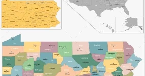
Pennsylvania Map
Map of Pennsylvania state designed in illustration with the counties and the county seats
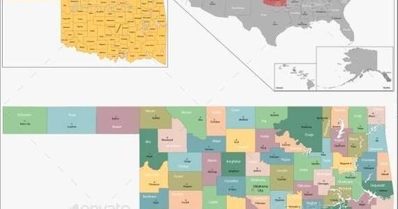
Oklahoma Map
Map of Oklahoma state designed in illustration with the counties and the county seats
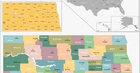
North Dakota Map
Map of North Dakota state designed in illustration with the counties and the county seats
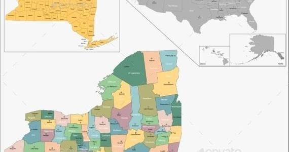
New York Map
Map of New York state designed in illustration with the counties and the county seats
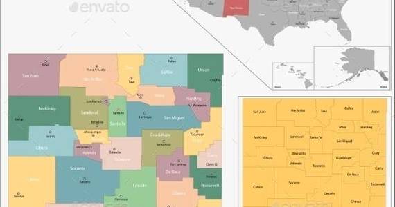
New Mexico Map
Map of New Mexico state designed in illustration with the counties and the county seats
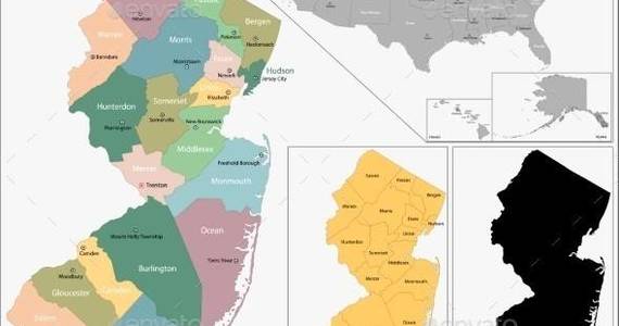
New Jersey Map
Map of New Jersey state designed in illustration with the counties and the county seats
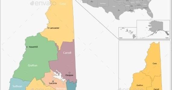
New Hampshire Map
Map of New Hampshire state designed in illustration with the counties and the county seats
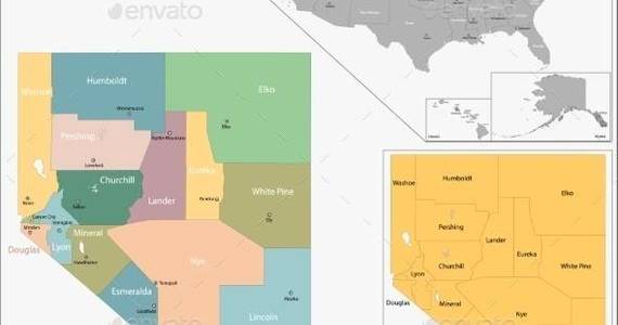
Nevada Map
Map of Nevada state designed in illustration with the counties and the county seats
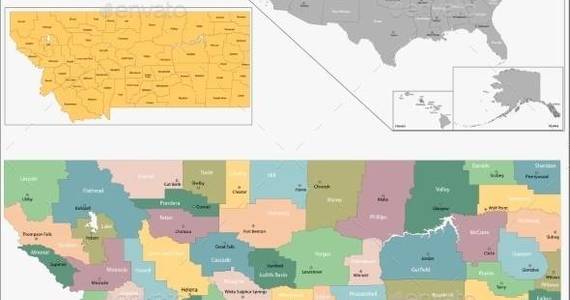
Montana Map
Map of Montana state designed in illustration with the counties and the county seats
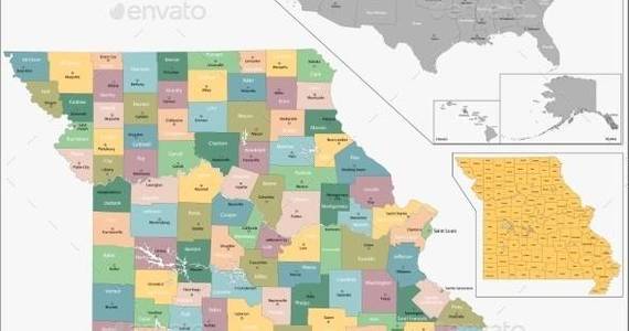
Missouri Map
Map of Missouri state designed in illustration with the counties and the county seats
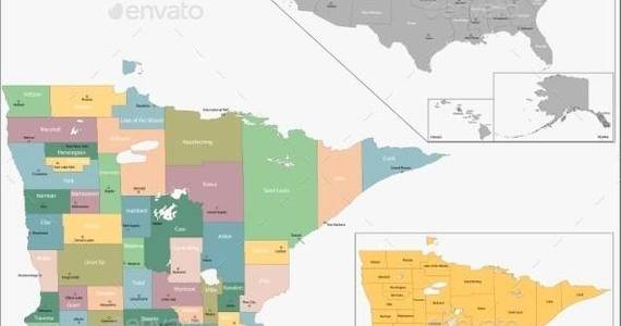
Minnesota Map
Map of Minnesota state designed in illustration with the counties and the county seats
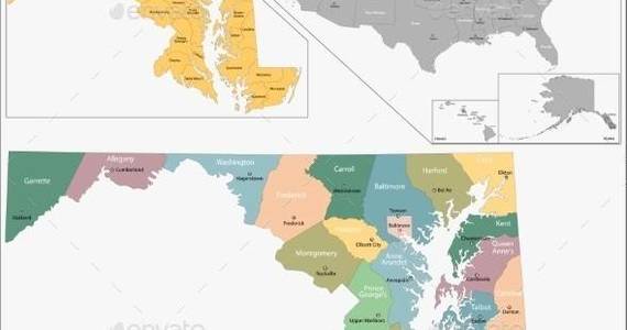
Maryland Map
Map of Maryland state designed in illustration with the counties and the county seats
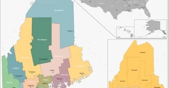
Maine Map
Map of Maine state designed in illustration with the counties and the county seats
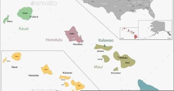
Hawaii Map
Map of Hawaii state designed in illustration with the counties and the county seats
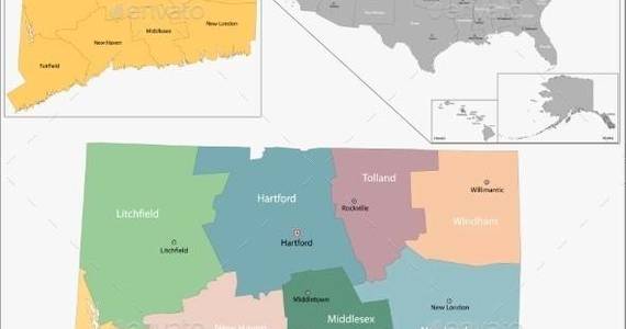
Connecticut Map
Map of Connecticut state designed in illustration with the counties and the county seats
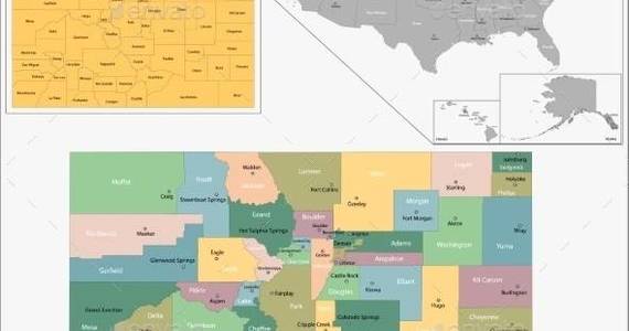
Colorado Map
Map of Colorado state designed in illustration with the counties and the county seats
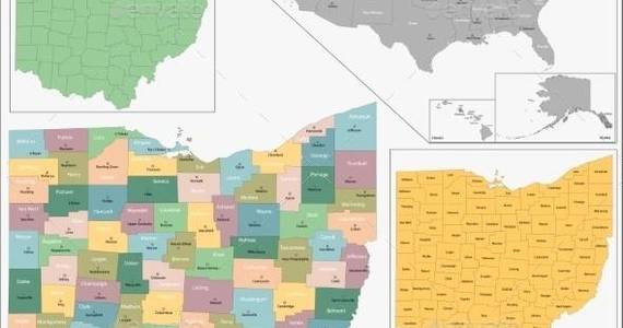
Ohio Map
Map of Ohio state designed in illustration with the counties and the county seats
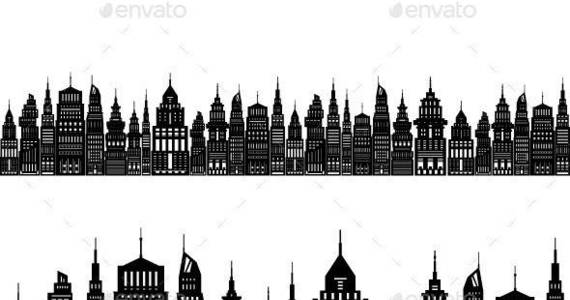
Modern Big City
Silhouette Modern Big City with Buildings and Skyscraper, Architecture Megapolis, City Financial Center on a Light Background ,Black and White Vector Illustration
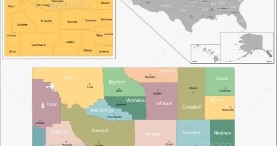
Wyoming Map
Map of Wyoming state designed in illustration with the counties and the county seats
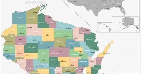
Wisconsin Map
Map of Wisconsin state designed in illustration with the counties and the county seats
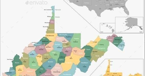
West Virginia Map
Map of West Virginia state designed in illustration with the counties and the county seats

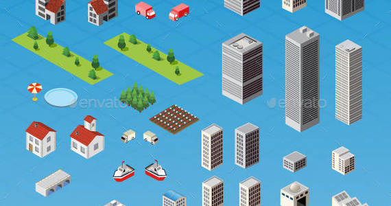
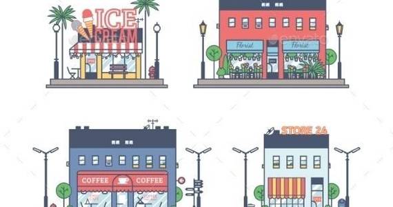
Constructor Cities
Constructor cities. A set of buildings, houses, transport and urban infrastructure elements. It allows you to design and build a city of any complexity. Each object in a separate file P...