
USA Maps with Animation
USA Maps with Animation
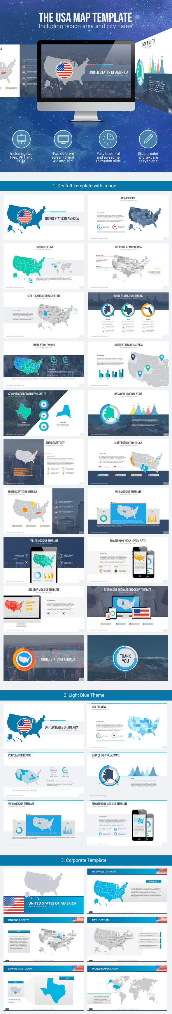
SlideKingdom is proudly present its second map edition – USA Maps with Animations
Engage your audiences’ attentions and communicate your ideas by using this visually appealing USA Maps with Animations. The maps can be easily broken down to countries.
All slides are fully editable with more than one template options (including HD size and PowerPoint Size).
Get in touch with our team on SlideKingdom@yahoo.com if you need further assistance. We’ll be glad to help.
WHY SHOULD SlideKingdom?
- Fully editable and easy to recolor
- Three different templates are available inside
- Same style and design which will ease you to compile any slides from SlideKingdom
- 19:6 & 4:3 HD size and default power point size
- New product available every week
- Maps, Diagram, Chart-Data, and New Template will be launched soon
FEATURES:
- 16:9 corporate, default, blue and yellow color in PPT, PPTX and HD sizes
- 4:3 corporate, default, blue and yellow color in PPT, PPTX and HD sizes
- Icons related to the theme
- Full Animations slides
- PDF Guide and info